Project Update: March 17, 2025
We've got a few opportunities to utilize Project WeatherEye over the next few days. It's really a choice between winter and spring, no joke. We'll take a look below.
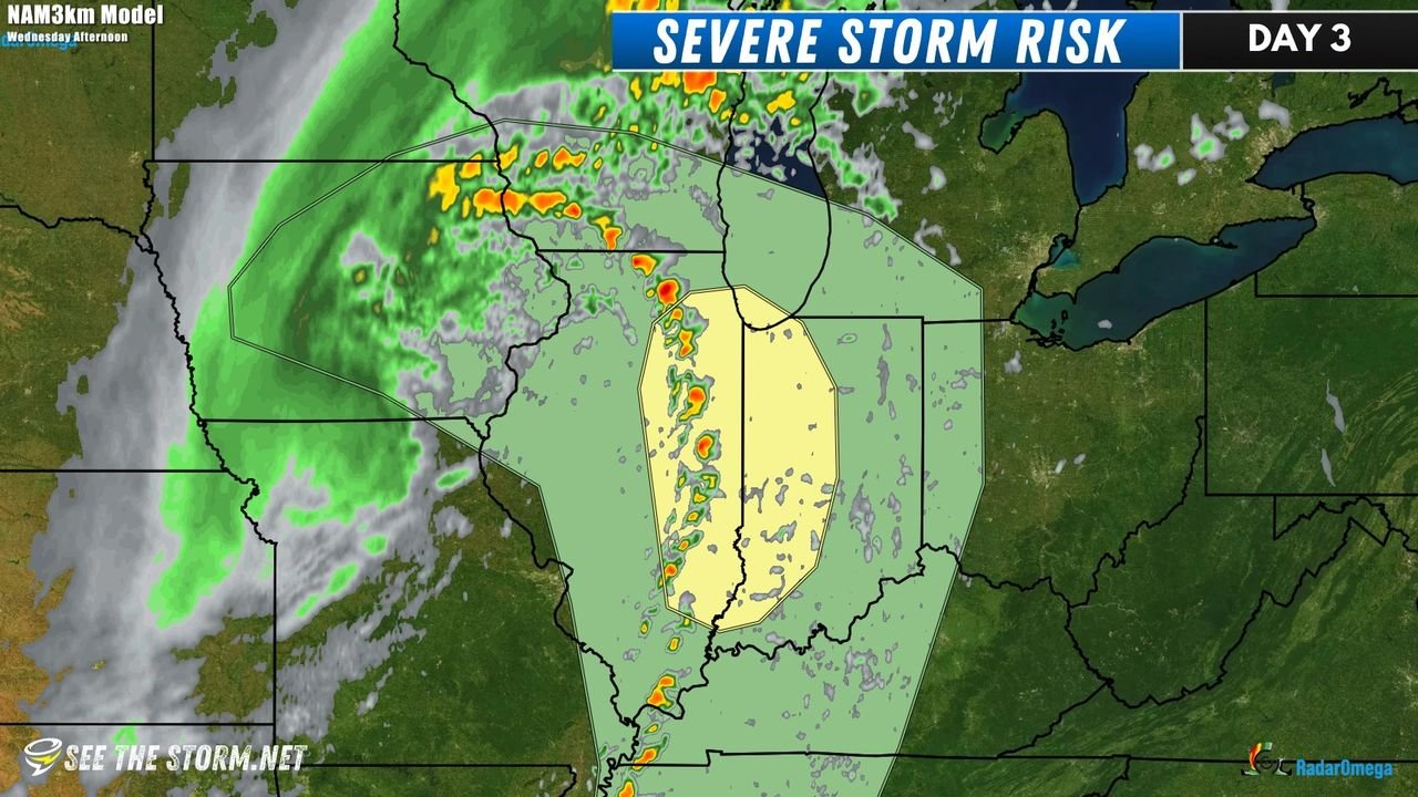
WEDNESDAY (spring): First opportunity is somewhat of a coin flip. There is a risk for severe storms in parts of Illinois and Indiana. It's a slight risk, which is a level 2 of 5, so nothing too crazy. Take a look at the risk area map below, where we've overlaid the NAM3km model for around 4PM.
There's an obvious arc of potential supercells stretching from SW Wisconsin to as far south as western Tennessee. With storm systems like this, the tornado potential usually maximizes closer to the low pressure center, so the target area would likely be from central and northern Illinois to western Indiana, right where the SPC has the yellow risk area currently. being Monday evening, model data isn't super reliable in terms of future reflectivity (radar) such as this, but its noteworthy to keep an eye on. Would not be surprised to see the SPC issue a 5% tornado risk contour for parts of that slight risk. This wouldn't be a large-scale deployment, but we may have an opportunity in a more normal paced environment to deploy some project equipment!
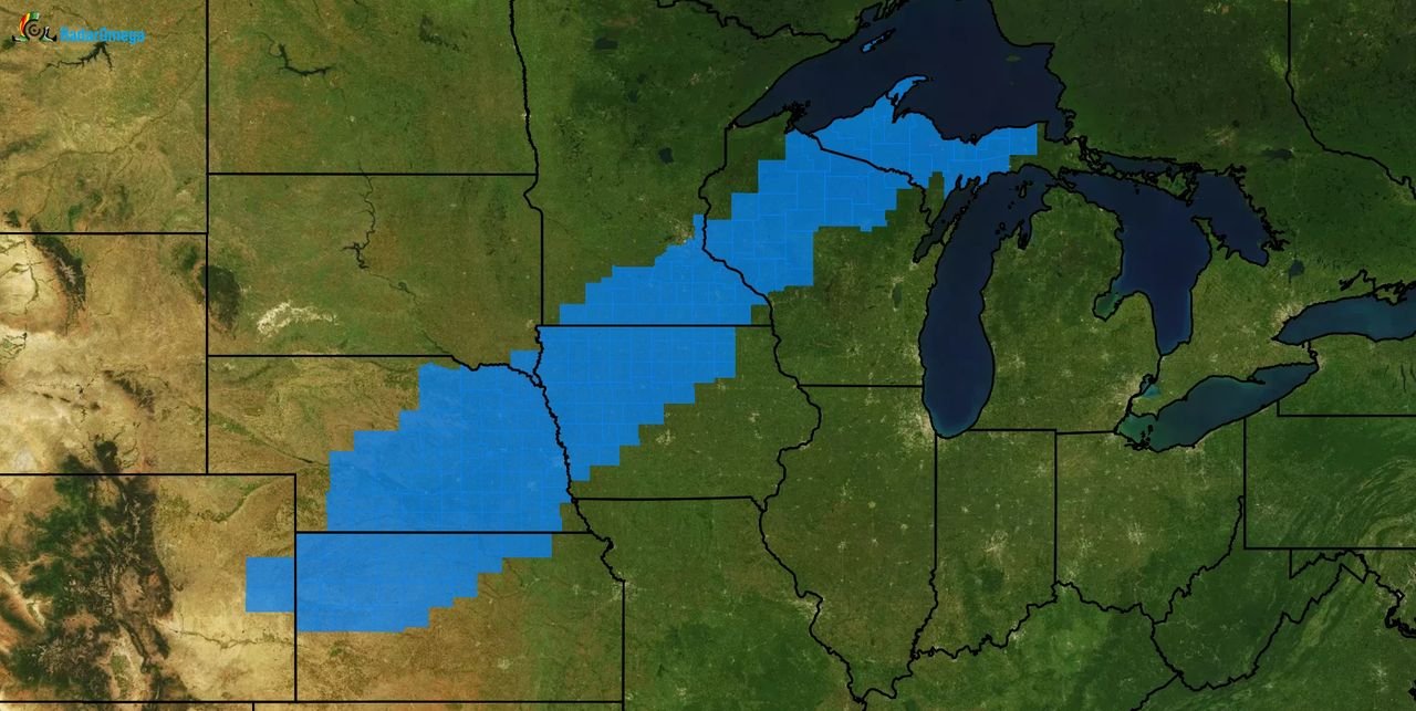
WEDNESDAY (winter): Below is a map showing the current Winter Storm Watch counties as of Monday evening. Expect some of those to get Warning status as early as late tonight, but most certainly Tuesday morning.
Current indications suggest this is more of a wind event with some snow sprinkled in. As little as an inch or two for the southern portion of the watch, but anywhere from 3-8 for areas farther north. Expecting 35-45mph wind. Certainly a near-blizzard situation if not full fledged blizzard status in some areas. Could be a cool opportunity for a deployment of some cameras on busy roads.
THE DECISION: We don't know! However current preference is the severe weather risk, but monitoring closely!
SUNDAY MARCH 23: The SPC has highlighted an area from I-35 in Oklahoma/Texas, thru the Ark-La-Tex region and east into Mississippi for potential severe storms. It's too early to make calls on what/when/how/expectations, but this is certainly on the upcoming radar.


